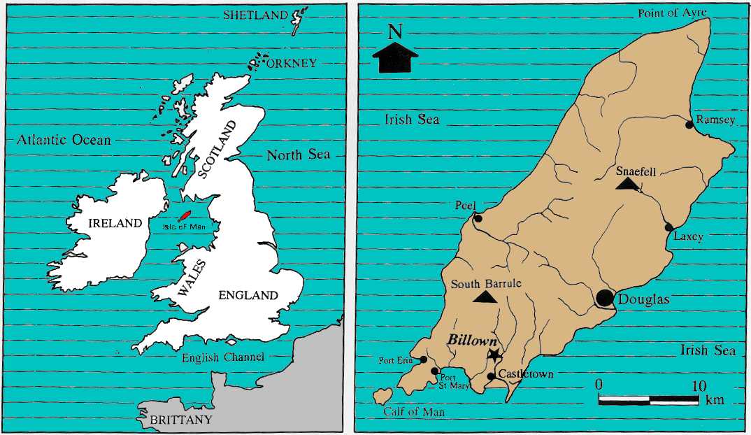
 Billown
is situated in the southern part of the Isle of Man, approximately 2.5km north
of Castletown and 1.2km west of Ballasalla, in the parish of Malew, sheading
of Rushen. The main excavation site is centred on NGR SC 268702 and occupies
slightly elevated ground (c.40m OD) within a generally undulating plain.
It lies on a narrow interfluve between the Silver Burn to the east and a stream
from Chibbyr Unjin to the west. Both watercourses run southwards, emptying into
the Irish Sea at Castletown and Poyll Vaaish respectively. On a clear day there
are good views from the site. To the north is upland, dominated by South Barrule
with its hillfort crowned summit at 483m OD. To the north-west and west are
further hills, many rising to over 200m OD, while to the south-west it is possible
to see the coast with the Irish Sea beyond. Views south and east are more restricted,
but in general look out over the coastal plain and the valley of the Silver
Burn.
Billown
is situated in the southern part of the Isle of Man, approximately 2.5km north
of Castletown and 1.2km west of Ballasalla, in the parish of Malew, sheading
of Rushen. The main excavation site is centred on NGR SC 268702 and occupies
slightly elevated ground (c.40m OD) within a generally undulating plain.
It lies on a narrow interfluve between the Silver Burn to the east and a stream
from Chibbyr Unjin to the west. Both watercourses run southwards, emptying into
the Irish Sea at Castletown and Poyll Vaaish respectively. On a clear day there
are good views from the site. To the north is upland, dominated by South Barrule
with its hillfort crowned summit at 483m OD. To the north-west and west are
further hills, many rising to over 200m OD, while to the south-west it is possible
to see the coast with the Irish Sea beyond. Views south and east are more restricted,
but in general look out over the coastal plain and the valley of the Silver
Burn.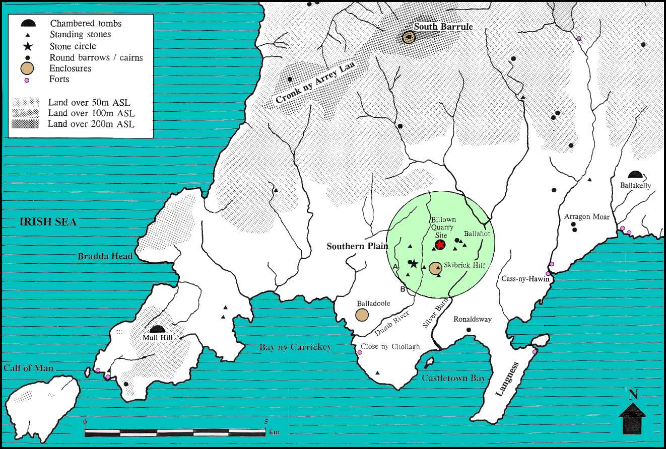
The geology of the Billown area is described in detail by Lamplugh (1903) and more recently by Dickson, Ford and Swift (1987). The underlying solid geology is Carboniferous Limestone of the Castletown formation, but the limestone is capped by up to 4m of glacial till. The base-rich soils which have developed on this till are among the most fertile on the Island (Kear 1976, 48).